South America
This term the children will be studying South America. Here is a copy of their journey.

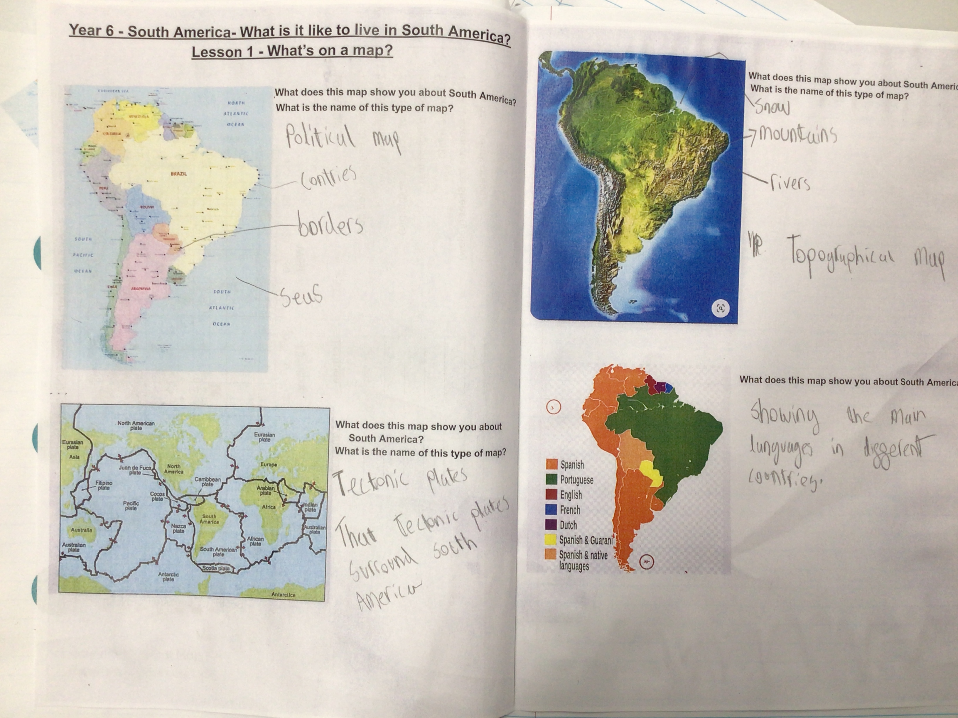
During the first part of the lesson, the children recapped the different lines of latitude and longitude they have learnt throughout key stage 2. Then, they compared four different types of maps about South America: relief maps, political maps, tectonic plate maps and language maps.
Finally, the children used their knowledge of longitude and latitude as well as understanding that there is 15 degrees between each line of latitude on a map. Once this was understood, the children identified the latitude and longitude for different places on the world map.


Comments
Post a Comment